Working with Point Cloud Data in QGIS (North America-friendly time)
- Time18-21 CEST/ 12-15 EDT/ 9-12 PDT
- Duration2 sessions (4 hrs)
- Price€250/$290 excl. VAT
- PlaceOnline
- TeacherKurt Menke
Course content
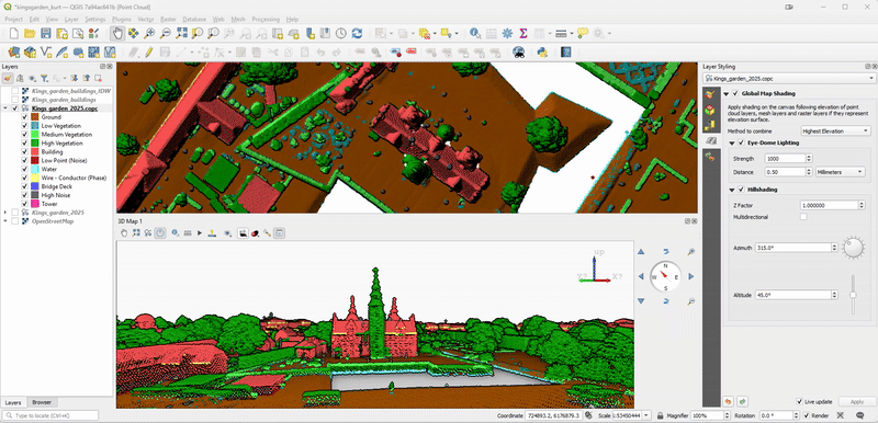
Point cloud support was first added to QGIS in 2021 at version 3.18. New point cloud functionality has been added at nearly each release since, including the most recent version: QGIS 3.44 Solothurn. The most recent functionality introduced, is the ability to edit point cloud attributes.
This course is designed for those who are already familiar with QGIS, but want to expand their skills and learn to work with point cloud data. The course will begin with the basics: What are point cloud data and what can you do with them? The introduction will also include the different supported file formats along with sources for obtaining open point cloud data.
The next section will teach you to visualize point clouds in both 2D and 3D. Here you will learn different ways to highlight important information and features.
Finally you’ll learn to process point cloud data. Just as with vector and raster data, point cloud data often need to be processed before use. Here you will learn to merge, clip and filter the data for your specific project. This will include creating Virtual Point Clouds. You will also learn to edit point cloud attributes. Then you’ll learn to convert points clouds, for example, creating a digital surface model from the point cloud.
The course will conclude with automating point cloud processing using PDAL wrench, which is included with QGIS.
This four hour course will teach you everything you need to know to begin working with point cloud data in QGIS!
After this course you’ll be able to:
- Load and display point clouds in 2D.
- Style point clouds using different attributes and color palettes.
- Navigate and interact with point clouds in 3D.
- Create profiles plots and cross sections.
- Filter and clip point clouds to focus on specific areas of interest.
- Perform basic point cloud processing tasks, such as calculating point density and creating digital surface models.
- Edit point clouds to correct attribute errors.
- Work with PDAL_wrench.
Course format
The course consists of:
- An introductory video
- One three-hour class session
- An assignment to be completed after the course session
- One question / answer session with the opportunity to ask questions about point cloud data with QGIS and any issues encountered
Introductory video: One week before the course starts you will receive an introductory video with an introduction of point cloud data.
Course session: During the live course, Kurt Menke will lecture about working with point cloud data in QGIS and interactively demo features.
Assignments: To support learning, after the course session you will be assigned a short assignment taking approximately 1-2 hours to complete.
Question/answer session: This will be held one week after the course session. During this session you have the opportunity to ask questions about point cloud data and any issues encountered.
In addition you will receive a brief manual, short task-based videos and recordings of the course sessions.
Course dates
- Course Session: Tuesday 15 October from 18-21 CEST/ 12-15 EDT/ 9-12 PDT
- Question/answer session: Tuesday 22 October from 18-19 CEST/ 12-13 EDT/ 9-10 PDT
Course price
€250/$290
QGIS certified course
The course is certified by the QGIS organization, which has approved the material and the course program. You will receive an official certificate after completing the course.
Practical information
The course is held in English.
In order to be able to use the new editing functionality, you will need to use QGIS version 3.44 or greater for the course. QGIS with the English translation will be used.
Register before: 8 October 2025.
Contact Kurt kurt@septima.dk, if you want to hear more about the course.